
Maps & GIS Data
2020 census maps by geographic area
1880-2010 Censuses
Document
Document
Document
Other Boundary Maps
- Alaska Native Regional Corporations Maps (13 pages)
- Alaska Native Regional Corporations Statewide Wall Map
- Legislative Districts
- School Districts (54 pages)
Population Maps
- 2010 Census Total Population by Borough/Census Area
- 2010 Census Proportion of Statewide Population by Borough/Census Area
- 2000-2010 Regional Migration Flows
- 2000-2010 Migration to Alaska by State
- Alaska Native Population at the Time of Contact with Europeans
Net Migration Maps
Economic Regions
GIS Data
2020 Census
File Descriptions
2010 Census
File Descriptions
Historical Census
Shapefiles
Useful Links
Maps
- Alaska Department of Natural Resource Map Page
- Alaska Department of Transportation Map Page
- Alaska Fish and Game Map page
- Alaska Judicial Districts
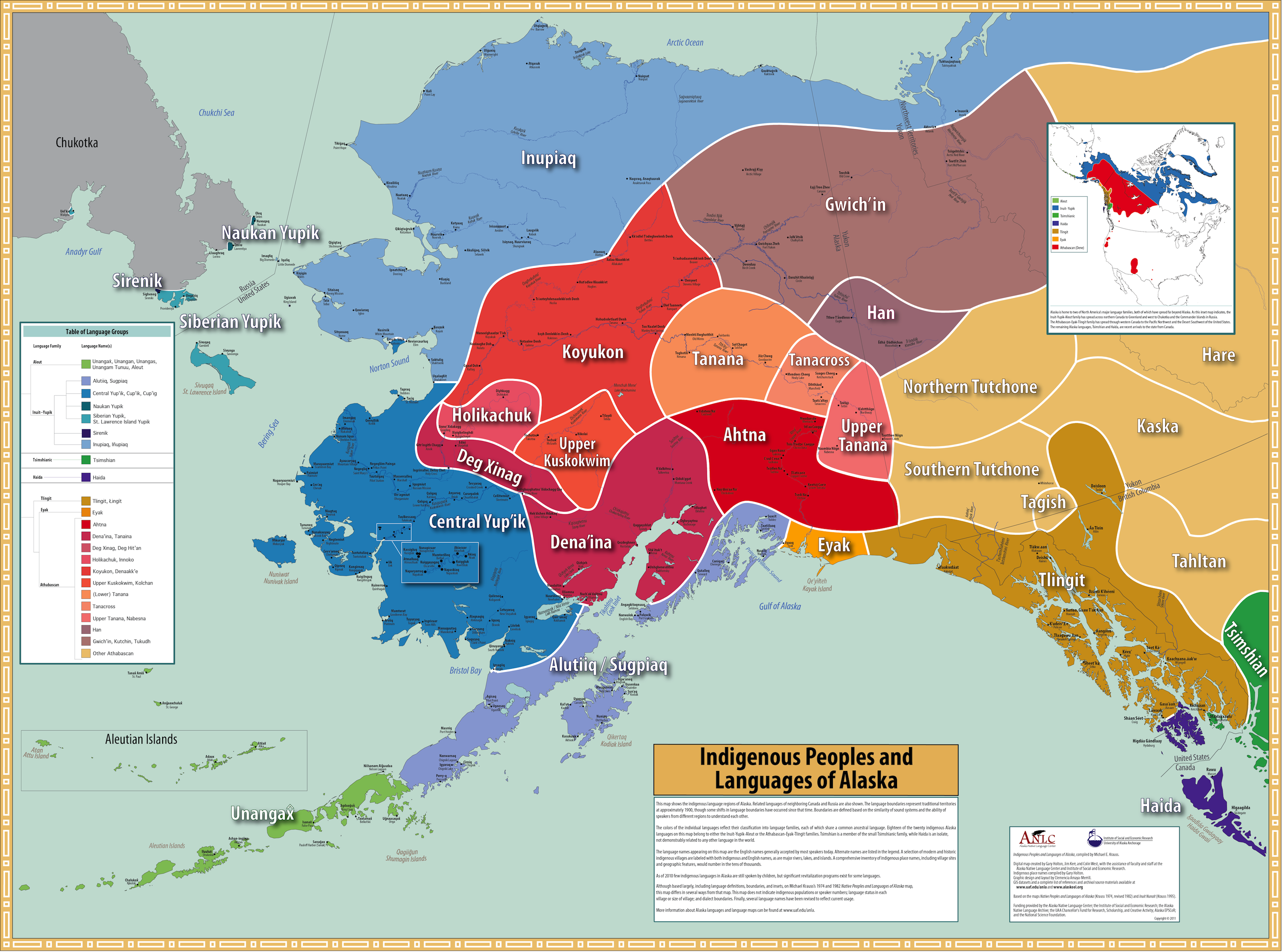
- Native Alaskan Peoples and Languages
- The National Map, USGS
- Who Owns/Manages Alaska?
GIS Data
- Kenai Peninsula Borough GIS
- Ketchikan Gateway Borough GIS
- Kodiak Island Borough GIS
- Matanuska-Susitna Borough GIS
- Municipality of Anchorage GIS
- National Historical Geographic Information System
- U.S. Census Bureau TIGER/Line Shapefiles